Check Out Goat Maps, A Brand New GPS App For iOS

Goat Maps just released version 1.0 of their brand new GPS app for iOS today. We’ve been following along on the development for a while through the beta and have been extremely impressed. Whether it’s zooming in and out of maps or downloading quadrants of maps for offline use, this app has definitely been built for speed.
The interface is very minimal including the colour scheme (which is meant to reflect a sunset) with fewer colours to avoid unnecessary distractions. Most of the basemap data is provided by Open Street Map (in conjunction with data from OSM, Overture, and other data sources) and one of the creators, Jesse Crocker mentioned that they hope to add even more data sources as they continue work on the app.
Jesse along with Anna Hentzel Johnson were co-founders of a different app that you might be already familiar with called Gaia GPS. Unhappy with the direction of that app, they went off and sought to make something better and now after eight months of hard work, Goat Maps is ready. There has been a great focus on design and it shows…
“The minimal number of UI elements, and limited options in the app is very intentional. Some of our competitors have turned into a “build your own map toolkit”, which can be nice, but generally having too many options means none of them end up being great, and means lots of work going into features that very few people actually use. We currently are not trying to build an app for everyone, we are trying to build an app that will work really well for ourselves, and hoping that our use is representative of enough people to keep the lights on.”
That focused mantra is quite evident from the slogan on their website “Maps, Route Planning, Navigation. No BS” and through their social media postings (Follow them on Facebook, Instagram and Threads). I asked Jesse if there was going to be an Apple Watch app (as I can’t believe that WorkOutdoors and FootPath are still the only decent options aside from the sparse (although growing) offering that Apple Maps provides hikers) to which he said they weren’t currently planning that functionality. Disappointing, but he reaffirmed what the purpose of the app truly should be…
“One of my beliefs with app design is that the normal metric people use to measure the success of apps and websites, engagement or session time, is totally wrong for this type of app. If our app design and map is working properly you shouldn’t feel the need to pull your phone out every 15 minutes while hiking, you should look at the map, and then have a good enough mental picture of your route to hike for an hour.”
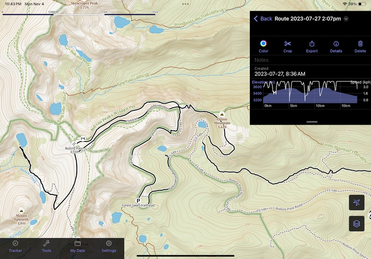
You can import .gpx tracks with ease and in turn, I had fun looking back on a hike I did last year in Colorado from the data gathered from my Apple Watch Ultra (although I could relive how much altitude really slowed me down. Ooof!).
Being an iOS app, not only does it work on iPhones, but you will appreciate the extra screen real-estate when using it on an iPad. The app also works seamlessly with an Apple Pencil for drawing out a route and swapping between adding points manually and drawing routes freehand. Even canoeists like me can find this app extremely helpful when planning routes. For existing trails each point you add for your route automatically snaps to the trail making planning a breeze. Dreaming of a canoe route? Switch over to ‘draw’ mode to trace a route amongst the lakes and rivers. There’s barely any re-draw time when pinching and zooming to get a better look at the waterways.
Screenshot from an earlier beta build, some of the interface elements might have changed in the full release.
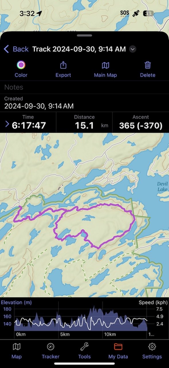
You can also use Goat Maps to track hikes as you go as it records speed, elevation, distance, ascent and more. I found the offline maps extremely quick to add to your library (in fact you don’t even need the app open to continue downloading) and quite large as far as geographical boundaries go.
Tracking without cell service has been perfectly reliable and I haven’t had any missing segments of my routes to date within the app. Change your mind and want to shorten or lengthen your hike while you’re out there but unsure which route to take? Just a few minutes with the app will give your exactly what you’re looking for.
Downloads are quick if you’re in a last minute scramble before you loose cell range.
Hybrid view
There are currently three map layers (Topo, Satellite and Hybrid) and four different U.S. centric overlays (Historic fires, USFS Timber Harvests, Public Lands and PLSS) with Government Topo and Private Land coming at a later date. Design-wise they are looking to keep the overlays somewhat reserved so that they know all of the information is up to date and accurate.
While there is no Android version currently in the works, Jesse didn’t rule it out. Next on the roadmap is a web version of the app (and perhaps a Mac version too) and if iOS sales do well and the demand for an Android version is there, perhaps one day that will happen. This app has been the fruit of some extremely hard work from a very small team.
Download Goat Maps today from the App Store and give it a try. Base functionality is free, and you can subscribe to a one year membership for $39.99 CAD which unlocks unlimited offline maps (for when you don’t have cell service) and the ability to plan routes. Until the end of November 2024, use code: LAUNCH for $10 off a yearly membership.


